


Church Of Christ Meridianville, Madison County, Alabama
About
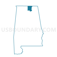
Outline

Summary
| Unique Area Identifier | 522386 |
| Name | Church Of Christ Meridianville |
| County | Madison County |
| State | Alabama |
| Area (square miles) | 22.94 |
| Land Area (square miles) | 22.84 |
| Water Area (square miles) | 0.10 |
| % of Land Area | 99.56 |
| % of Water Area | 0.44 |
| Latitude of the Internal Point | 34.87746540 |
| Longtitude of the Internal Point | -86.56290520 |
Maps


Graphs
Select a template below for downloading or customizing gragh for Church Of Christ Meridianville, Madison County, Alabama


Neighbors
Neighoring Voting District (by Name) Neighboring Voting District on the Map
- Chase Valley United Meth, Madison County, AL
- County Commission Dist 1 Office, Madison County, AL
- Lewis Chapel CP Church, Madison County, AL
- Locust Grove Baptist Church, Madison County, AL
- Mary Kelly Johnston Gym, Madison County, AL
- Meridianville 1st Bapt Church, Madison County, AL
- Plainview Church of Christ, Madison County, AL
- Toney United Methodist Church, Madison County, AL
Top 10 Neighboring County Subdivision (by Population) Neighboring County Subdivision on the Map
- Huntsville CCD, Madison County, AL (215,955)
- New Market CCD, Madison County, AL (14,871)
- Madison Crossroads CCD, Madison County, AL (12,763)
- Hazel Green CCD, Madison County, AL (11,993)
Top 10 Neighboring Place (by Population) Neighboring Place on the Map
- Huntsville city, AL (180,105)
- Meridianville CDP, AL (6,021)
- Moores Mill CDP, AL (5,682)
- Hazel Green CDP, AL (3,630)
Top 10 Neighboring Unified School District (by Population) Neighboring Unified School District on the Map
Top 10 Neighboring State Legislative District Lower Chamber (by Population) Neighboring State Legislative District Lower Chamber on the Map
- State House District 6, AL (57,674)
- State House District 21, AL (48,999)
- State House District 22, AL (48,959)
Top 10 Neighboring State Legislative District Upper Chamber (by Population) Neighboring State Legislative District Upper Chamber on the Map
- State Senate District 2, AL (179,058)
- State Senate District 7, AL (148,905)
- State Senate District 8, AL (142,128)
Top 10 Neighboring 111th Congressional District (by Population) Neighboring 111th Congressional District on the Map
Top 10 Neighboring Census Tract (by Population) Neighboring Census Tract on the Map
- Census Tract 101, Madison County, AL (9,355)
- Census Tract 103.01, Madison County, AL (8,125)
- Census Tract 107.01, Madison County, AL (7,848)
- Census Tract 107.02, Madison County, AL (7,199)
- Census Tract 104.02, Madison County, AL (6,736)
- Census Tract 103.02, Madison County, AL (3,868)
- Census Tract 105.02, Madison County, AL (2,926)